plan your next trek
7 Days Machame Route Tanzania
7 day Machame route

7 Days Machame route is our most booked itinerary. The nickname “Whiskey route” is because the route is popular somehow challange to climb and more scenic that other routes.
On an overall comparison of the routes to scale Kilimanjaro, this is one of the best routes to take, both in terms of acclimatization and cost.
The 7 Days Machame route is considered a difficult route and is better suited for adventurous trekkers.
The Machame route is scenically beautiful and varied. However, due to its popularity there are increased numbers of trekkers and it loses some of its splendor.
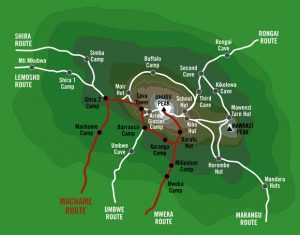
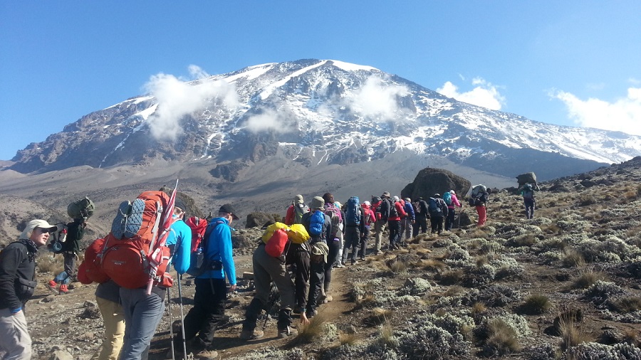
The Machame route approaches the summit from the southwest and descends using the Mweka route, rewarding climbers with views of the expansive Shira Plateau, an optional scramble up Lava Tower, a climb up the Great Barranco wall, and a traverse underneath Kilimanjaro’s southern ice field.
In certain sections this route is steeper than the Marangu and Rongai routes and physically more demanding but is easier overall.
Great for acclimatization with lots of walk high, sleep low opportunities.
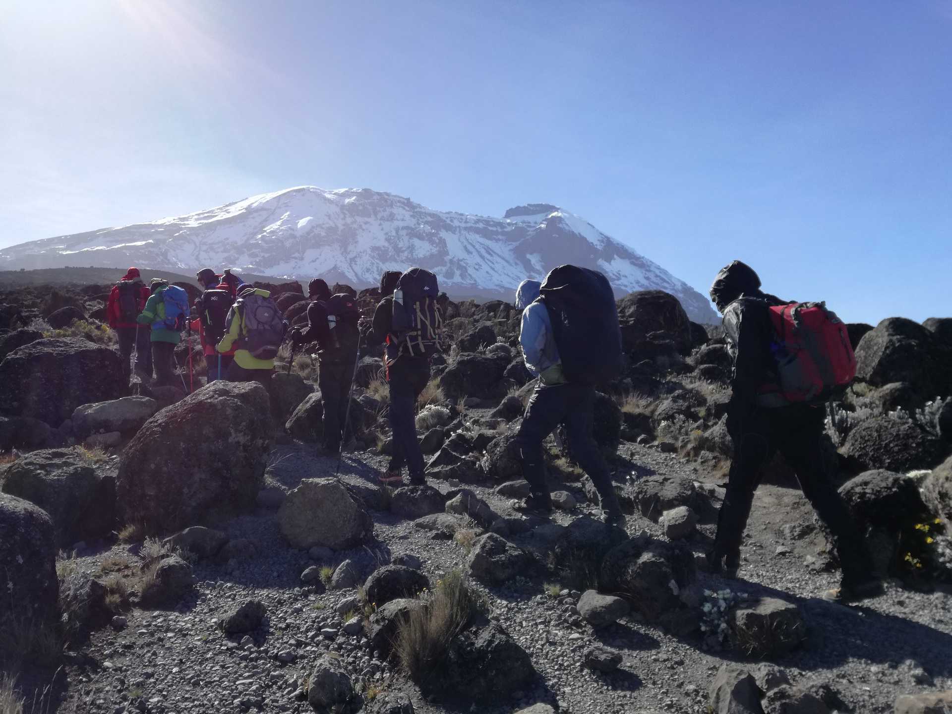
Challenging trek with stunning scenery through 5 diverse climatic zones.
Good opportunity to split pre-summit day climb to leave climbers rested before summiting.
Highlights: 7 Days Machame route
Very scenic when compared to other routes
A popular route due to it scenery
Can be climbed throughout the year
Destination; Northern Tanzania
Location; Kilimanjoro Region
Best time to climb; throughout the year
Scenery; Beautiful
View all the Kilimanjaro climbing routes
If you have opted for the optional airport transfers, we will pick you up from Kilimanjaro airport or Arusha airport and transfer you to your hotel in Arusha.
Pre-trek briefing at your hotel in Arusha. You should be planning to arrive at least one day before the start of the trek. Today we will spend in having a pre-trek briefing. We will also review your equipment and rent any equipment which is needed.
Drive from Moshi to Machame Gate takes about 45 minutes. The journey passes through the village of Machame which is located on the lower slopes of the mountain.
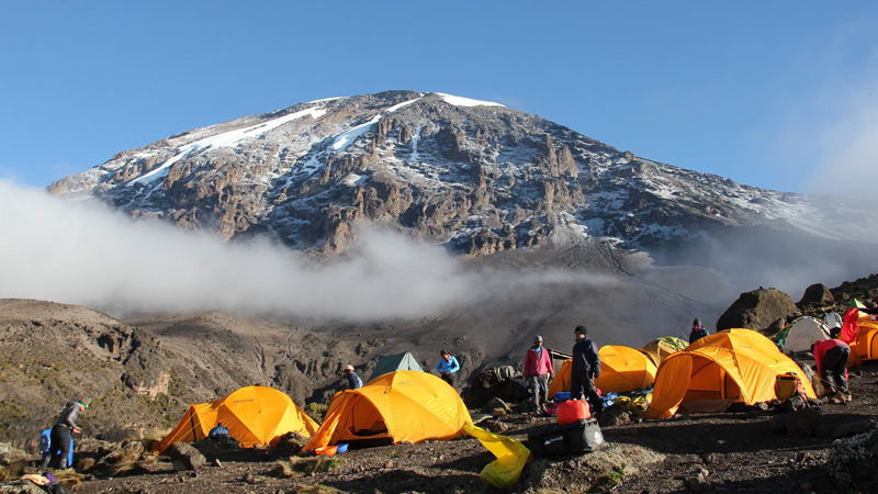
We depart the park gate and walk through the rain forest on a winding trail up a ridge. At lower elevations the trail can be muddy and slippery. Gaiters and trekking poles are a good idea here. We continue a short distance until we reach the Machame Camp.
Elevation: 1830m/6000ft to 3050m/9950ft
Distance: 11km/7mi
Hiking Time: 5-6 hours
Habitat: Montane Forest
Meals: Lunch and Dinner
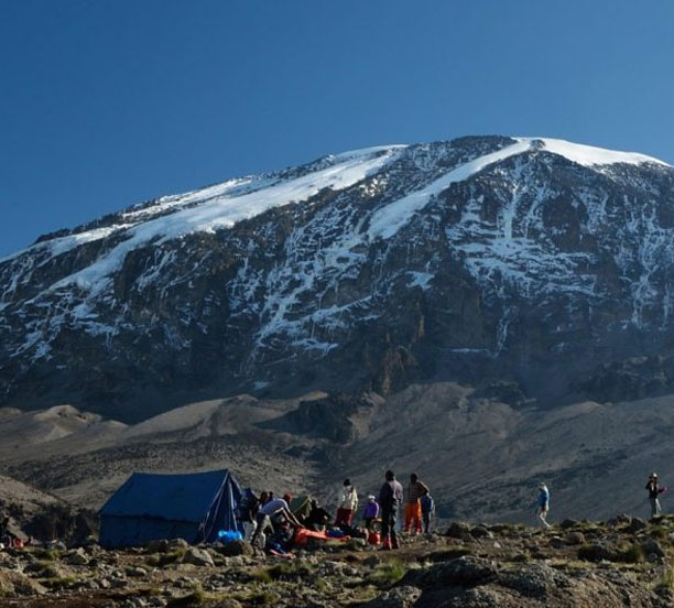
After breakfast we leave the glades of the rain forest and continue on an ascending path, crossing the valley along a steep rocky ridge. The route now turns west onto a river gorge until we arrive at the Shira campsite.
Elevation: 3050m/9950ft to 3850m/12,600ft
Distance: 5km/3mi
Walking Time: 4-5 hours
Habitat: Moorland
Meals: Breakfast, Lunch and Dinner
From the Shira Plateau we continue to the east up a ridge, passing the junction towards the peak of Kibo. As we continue, our direction changes to the South East towards the Lava Tower, called the “Shark’s Tooth” (elev 4650m/15,250ft). Shortly after the tower we come to the second junction which goes to the Arrow Glacier. We now continue down to the Barranco Camp. Although you end the day around the same elevation as when you began, this day is very important for acclimatization and will help your body prepare for summit day.
Elevation: 3850m/12,600ft to 4000m/13,000ft
Distance: 10km/6mi
Walking Time: 5-6 hours
Habitat: Semi-desert
Meals: Breakfast, Lunch and Dinner
After breakfast, we leave Barranco and continue on a steep ridge up the Barranco Wall to the Karanga Valley and the junction which connects with the Mweka Trail.
Elevation: 4000m/13,000ft to 4050m/13,250ft
Distance: 5km/3mi
Climbing Time: 3-4 hours
Habitat: Alpine Desert
Meals: Breakfast, Lunch and Dinner
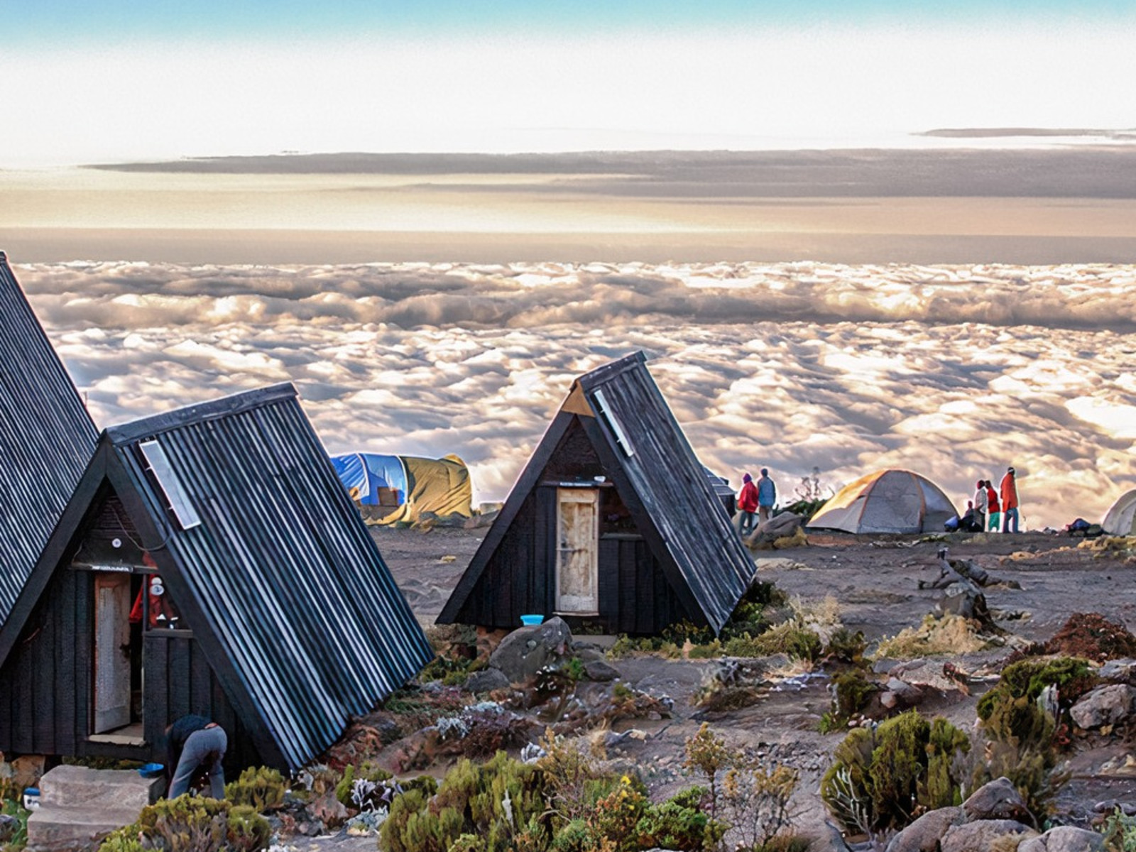
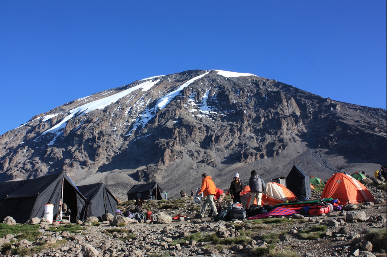
We continue up to the Barafu Camp. You have completed the South Circuit, which offers views of the summit from many different angles. Here we make camp, rest, enjoy dinner, and prepare for the summit day.
Elevation: 4050m/13,250ft to 4700m/15,350ft
Distance: 4km/2mi
Climbing Time: 3-4 hours
Habitat: Alpine Desert
Meals: Breakfast, Lunch and Dinner
After breakfast we continue the descent down to the Mweka Park Gate to receive your summit certificates. At lower elevations, it can be wet and muddy. Gaiters and trekking poles will help. Shorts and t-shirts will probably be plenty to wear (keep rain gear and warmer clothing handy).
Njofu Expeditons vehicle will be waiting for you at Mweka gate to drive you back to your hotel in Moshi or Arusha.
End of 7 Days Machame route
Elevation: 3090m/10,150ft to 1680m/5500ft
Distance: 10km/6mi
Hiking Time: 3-4 hours
Habitat: Forest
Meals: Breakfast
Sun glasses
Baraclevers
Head Lump
Warm jacket
Warm sweeter, 2 pairs
Warm sleeve Body tights
Rain jacket or Ponchot and Rain trousers
Warm trousers 2 pairs
Warm sleeve body tight
Sun screen lotions
Walking stick one pair (11) Warm Sox 2 pairs
Walking boots over size to allow to wear 2 pairs of SoxCloaves 2 pairs
Cloaves 2 pair, one big and one thinner
Wind breaker jacket
Warm sleeping bag
Private small first Aid Kit
Wind breaker trousers